Minerva in the Beautiful Adirondack Mountains
A Day in Minerva
Hiking in Minerva
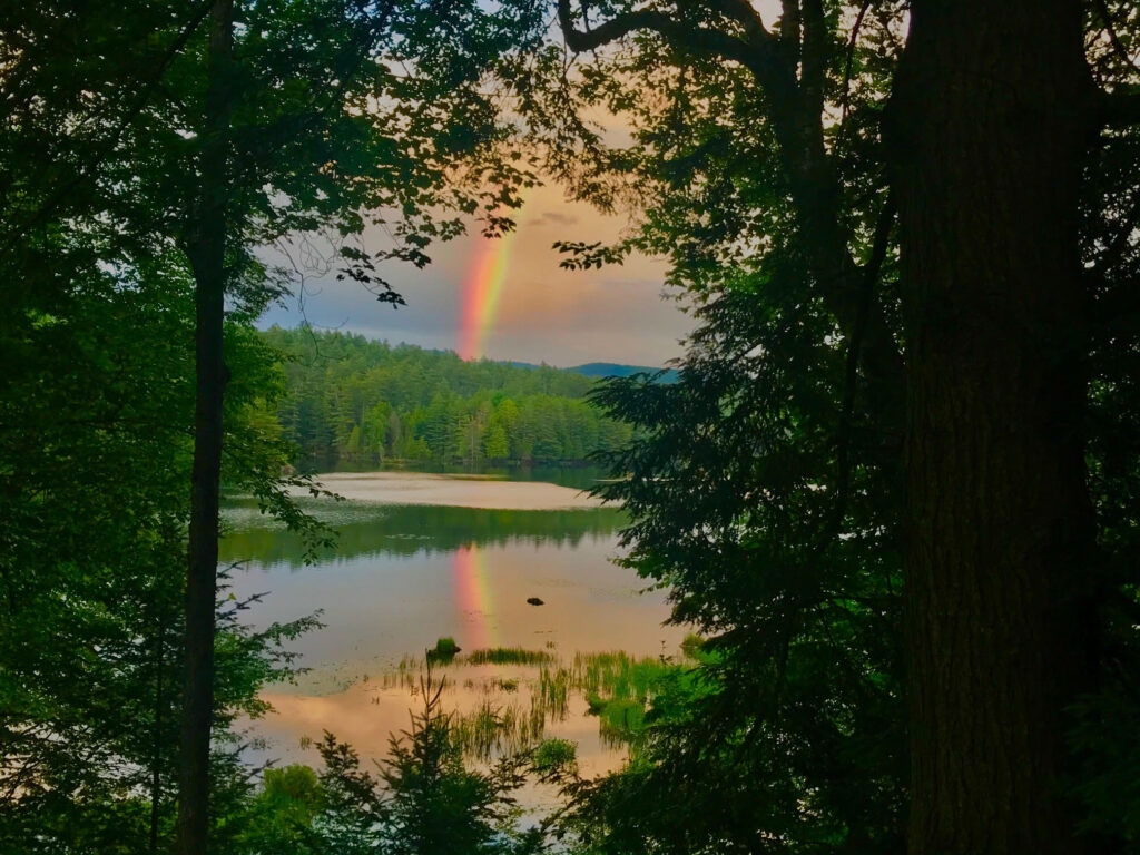
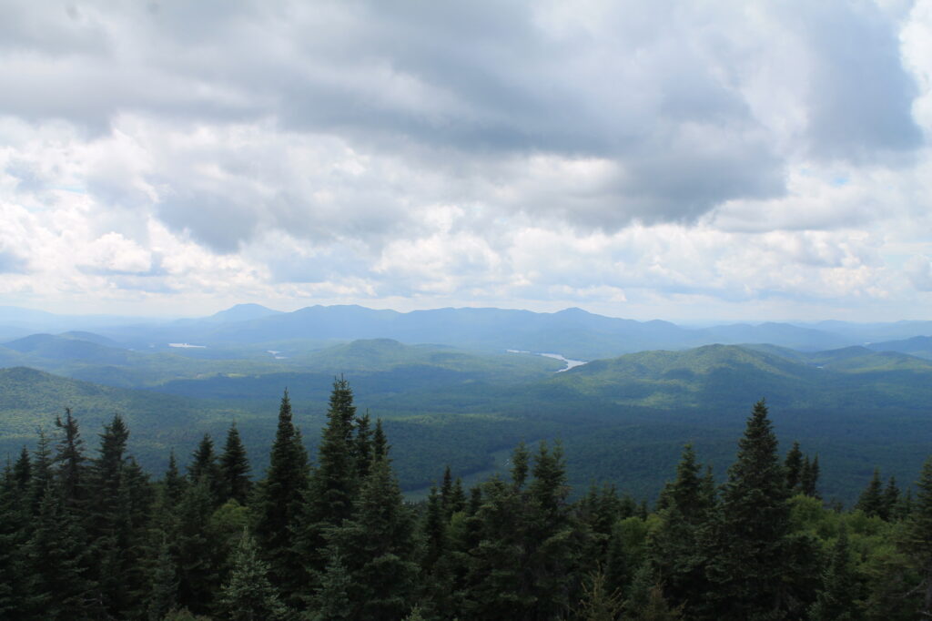
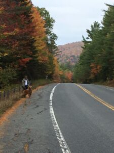
In summer, hikers travel from far and wide to the Adirondacks to experience the pristine natural beauty of the mountains, valleys, lakes and streams on more than 2,000 miles of New York hiking trails. Summer in northern New York hits full stride in northern New York, with the sun popping up just past 5 a.m. and daylight lingering until 9 p.m. Minerva has beautiful bodies of water and mountains. The town consists of state land and is rightfully known for the amazing scenery of its hikes, Many of the hiking trails lead to bodies of water, so the area is especially notable for hikes that form chains to different ponds from the same trailhead.
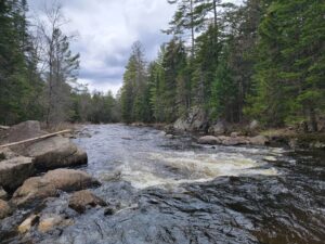
Blue Ledges
AllTrail-Blue Ledges Trail
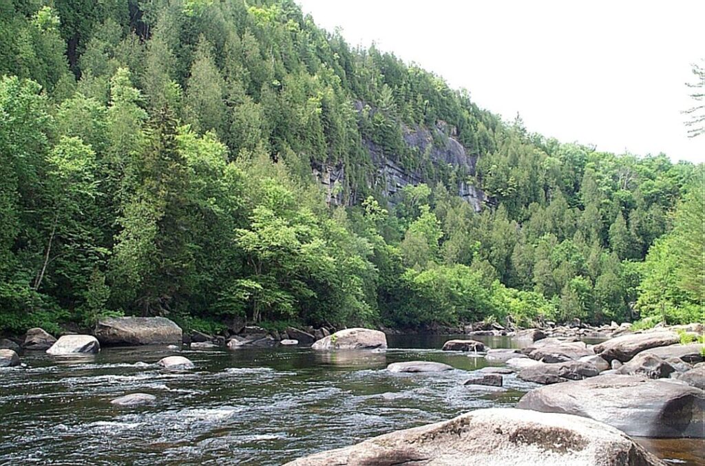
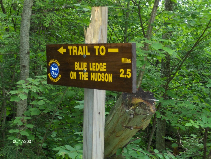
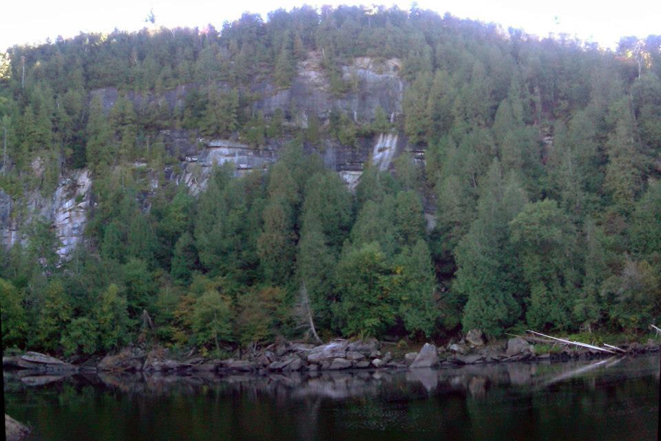
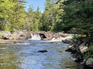
This hike takes you to the shore of the Hudson River at a scenic section of the river under massive granite cliffs known as the Blue Ledges. The river makes a right angle bend at this location and is filled with big boulders which, depending on the water level, may be well above the flow or part of a huge whitewater show. There is a small sandy bank shore for those who like to wade but be very careful-the current is swift.
The trailhead is along the North Woods Club Road (west off of NY 28N about 1.7 miles north of the Minerva Post Office) just before you reach Huntley Pond. The road is paved part way then becomes a well-maintained gravel road for the most part. It dips down to cross the Boreas River which is an interesting place to stop and explore along the way.
The start of the trail passes around the east end of Huntley Pond on a well-used trail marked with blue DEC markers. It is a 2.5 mile one way hike to the Hudson River.
Directions: From North Creek, take NY 28N north for 9.4 miles, then left on the North Woods Club Road for just under 7 miles.
Afterwards, stop at Minerva Beach to swim and have a snack at The Stand (summer), a beer and snack at Sporty’s Iron Duke Saloon or an ice cream, snack and coffee at Sullivan’s Store in Olmstedville.
Note: The Blue Ledges area is a mid-day stop for a large number of whitewater rafting companies that operate on Tuesday, Thursday, Saturday and Sunday. If you want a more tranquil hike, avoid Blue Ledges on those days or avoid a mid-day arrival to the Hudson River.
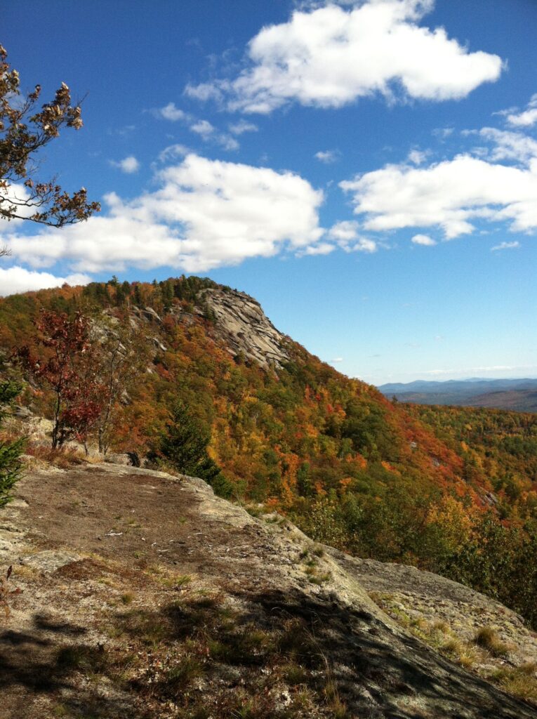
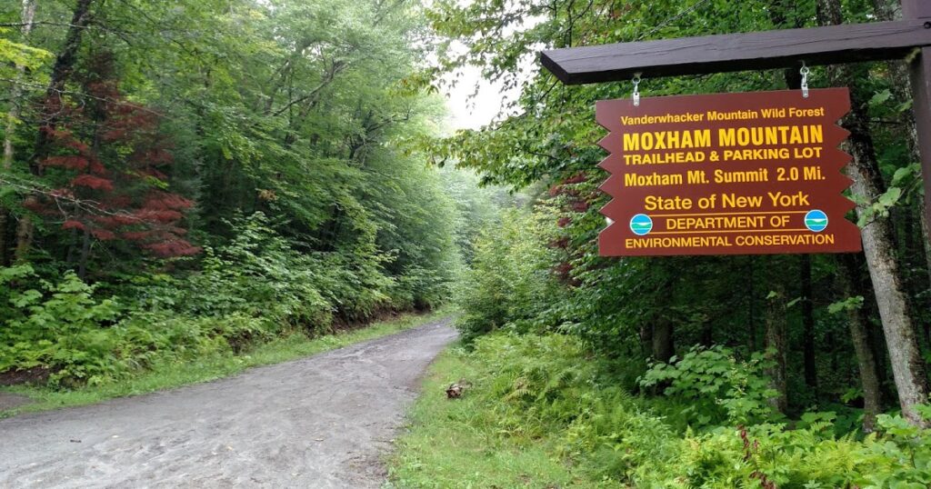
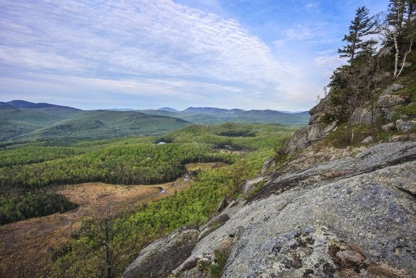
Moxham Mountain
AllTrail-Moxham Mountain Trail
Hiking review by Kate McCormick – Moxham Mountain
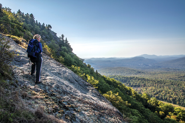
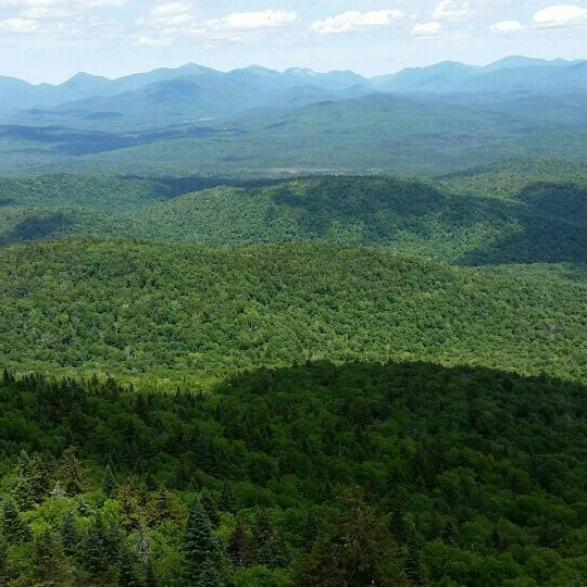
The 2.7 mile trail to Moxham Mountain was constructed in the summer of 2012 and features many overlooks with scenic views, while the most spectacular views are from the 2,418 foot summit. There is an elevation gain of 1,152 feet for this 2.7 mile hike to the summit, however the trail was built to minimize the climb as much as possible. This is a truly enjoyable hike with view, after view, after view of the southwestern ADKs. Moxham is part of the Vanderwhacker Mountain Wild Forest but it offers great views of the Siamese Ponds Wilderness area in and around Gore Mountain.
This hike begins at the small parking area along 14th Road off NY 28N in Minerva about 0.2 miles after the pavement ends. The only marking at the parking area is a “Trail Parking” sign, however it is pretty obvious as you drive down the dirt road on the left. The trail starts just off the small parking area (elevation 1,536 feet). You’re following yellow DEC trail markers. The trail immediately climbs and reaches the first of many overlooks at 0.6 miles (elevation 1904 feet). This view is just a teaser for what’s ahead, but is still a good place to take a break.
The trail now descends and at 1.0 miles crosses a small stream (elevation 1,724). It’s the outlet of an old beaver pond located just a short distance upstream. Now climbing again, pass a huge boulder on your left at 1.25 miles. Soon is another view, better than the first view with Gore Mountain as the main feature. At 1.6 miles reach the ridgeline (elevation 1,993 feet) and soon you start to reach one after another of the many overlooks that line this wonderful trail.
At 2.3 miles reach possibly the best of the pre-summit views as the cliffs of Moxham Mountain summit come into view (elevation 2,172 feet). Up there is your final destination and it is only 0.4 miles away. There are still more overlooks as you continue your climb toward the summit, reaching the 2,418 foot summit at 2.7 miles. While not a 360 degree view, the views are still spectacular and the open rocks offer a great picnic spot. As you approach the edge of the summit, remember you are on top of cliffs (so take special care). Moxham is named after a surveyor who took a wrong step while surveying the summit and died after falling from the cliffs.
Directions: Take NY 28N west out of North Creek toward Minerva. That major rock mountain on your left as you are driving along NY 28N is Moxham Mountain. In Minerva, turn left on 14th Road. Follow 14th Road to the end of the pavement and another 0.2 miles along the dirt road to the small parking area on the left. The GPS coordinates are N43 46.227 W74 00.720 for those who have GPS in their vehicle.
After leaving Moxham, stop at Betty’s Funny Farm on 14th Road and try out her selection of homemade jams and Maple Knoll Farm’s maple syrup. If it is a warm day and you would like to cool off – Minerva Lake is 2 minutes away with its classic ADK beach, bath house and concession stand. Take 14th Road across Rt. 28N and across Morse Memorial Highway, past Morningside and then take the next left onto Minerva (Donnelly) Beach.
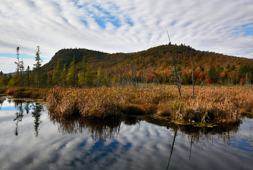
Vanderwhacker Mountain
AllTrail-Vanderwhacker Mountain Trail
The fire tower on the summit of 3,386 foot Vanderwhacker Mountain provides a spectacular view of the Adirondack High Peaks. There is an elevation gain of 1,686 feet on this 2.5 mile hike to the fire tower, but no views until you hit the peak.
The trail is marked with red disks and be sure to sign in at the trail register. Within the first mile, you will cross several small creeks and pass around wetlands. Then, the trail splits. The old road (now a snowmobile trail) continues to the left, while the path to the fire tower bears right. After passing two cabins used by the fire observer, you begin a strenuous climb up the mountain.
The total ascent from the trailhead is 1,686 feet with around 1,200 feet of that ascent done in the 1.3 miles after you reach the cabin. Part way along the steep section you will encounter a section of trail with switchbacks. After 2.5 miles of hiking you reach the fire tower. Climb the tower and enjoy the panorama of the high peaks to the north. The tower is in good shape and offers a 360 degree view. Many of the major High Peaks are visible from both the tower and the opening on the summit.
Directions: From North Creek, take NY 28N West for 16 miles. Immediately after the highway crosses the Boreas River, there is an unmarked gravel road on the left. Take this road for 2.6 miles to the point where it splits. The trailhead and parking is on the right.
The turnoff from NY 28N comes just after you cross the Boreas River and is marked by a DEC sign. The 2.6 mile road into the trailhead is not the best and it does get narrower beyond where it crosses Vanderwhacker Brook at 1.5 miles (where there are plenty of places to park and turn around). After crossing the Brook on a good bridge, if you notice that you are driving on the edge of a stream to your left, you are almost to the trailhead parking.

*CAUTION* The access road to the trailhead is a very rough road in spots. It is best driven with a high-clearance vehicle (like a pickup truck). It is possible to drive this stretch with a typical car as long as you should drive VERY SLOW. You can optionally park off NY 28N at the pull off on the right just before the bridge and walk in the 2.6 miles to the trailhead.
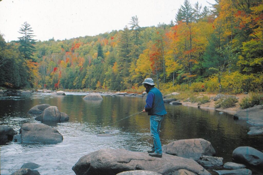
Boreas Loop Trail
AllTrail-The Boreas Loop Trail
Hiking review by Kate McCormick Boreas Loop Trail
The Boreas Loop Trail is a 2.7-mile loop trail near Minerva, New York. Generally considered a moderately challenging route, it takes an average of 1 h 5 min to complete. This is a popular trail for fishing and hiking, but you can still enjoy some solitude during quieter times of day. The best times to visit this trail are April through October.
Boreas River is a river in Essex County and Hamilton County in the U.S. State of New York. Boreas River begins at Boreas Ponds north-northeast of the Hamlet of Boreas River and flows southeastward before converging with the Hudson River southeast of Forks Mountain.
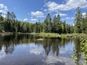
This tributary of the Hudson River gets its start at Cheney Pond in the town of Minerva. Here, you’ll find native brook trout. Farther down the river, however, the state regularly stocks brown trout each spring. Essex County usually adds larger rainbows and brook trout.
The Boreas empties into the Hudson River just south of the North Woods Club Road bridge. Access is available at several bridge locations.
_____________________________________________________________________________________________________________________________________________________
NORTH COUNTRY NATIONAL SCENIC TRAIL-ADIRONDACK PARK
There are existing trails on the North Country National Scenic Trail (NCNST) that cross the Adirondack Park
Interesting information:
NCNST spans 4700 miles from North Dakota to the Appalachian Trail in Vermont. Its current features include:
- It is the longest of the 11 National Scenic Trails,
- has about 3200 miles on the ground,
- about 158 miles are planned across the Adirondack Park,
- The NCNST is a premier, long distance hiking trail open to the public. The foot trail crosses both private and public land. It is important to note that the NCNST, in most sections, is designed and maintained as a primitive footpath and is marked by blue blazes.
The trail crosses areas of the town of Minerva:
Vanderwhacker Mountain Wild Forest: ADK Nat Geo Map 744
Raymond Brook Ski Trail
North Creek Ski Bowl
Road walk to North Creek, cross Hudson River on Route 28N
TBA: Moxham Mt., Fourteenth Rd., Minerva
Stony Pond and Hewitt Pond Trails (Rte. 28N & Rte. 24A) #59 , #56
TBA connector to Irishtown Snowmobile Trail
For more information check out the following websites:
The communities in the Adirondack Hub (Minerva, Newcomb, North Hudson and Schroon Lake) and have so much to offer during the summer season.
Discover The Adirondacks & Adirondack Mountains